
Discover Worcester County like never before with our Interactive GIS Maps. Whether you're a resident, business owner, or visitor, our online mapping tools provide easy access to valuable information about your community.
Worcester County’s Interactive Maps make it easy to explore and learn about our community. Whether you're curious about local zoning, land use, or your election district, our online maps give you quick access to helpful info—no downloads or special software needed. Just click a map and start exploring. More maps will be added soon, so check back often!
How to get started:
Select a map from the list below to begin. Each map is interactive and regularly updated to reflect the most accurate and current information available.
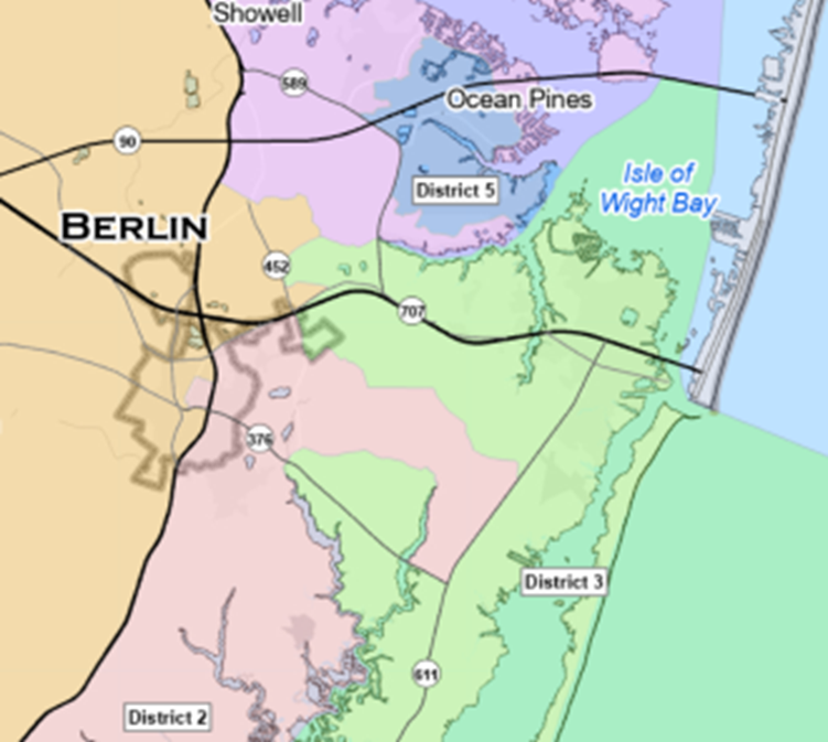
Election District Map - Official Election District Map that was adopted in 2023 including Polling locations and Legislative Districts.
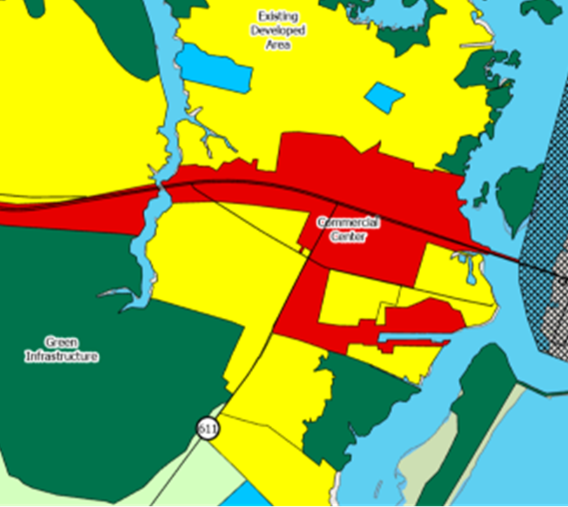
Land Use Map - Official Land Use Map that was adopted in 2006 including any amendments that have been approved. Land Use refers to the planned arrangement and regulation of how land within a community is developed and utilized to guide growth and ensure compatible, sustainable development.
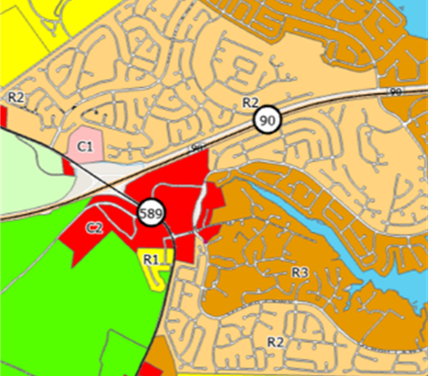
Zoning Map — Official Zoning Map that was adopted in 2009 including any rezonings that have been approved. Zoning establishes specific rules for how land and structures within each district may be used, developed, and maintained.
WORCESTER COUNTY GOVERNMENT CENTER
DRP Department
1 W. Market St. Room 1201
Snow Hill, MD 21863
Phone: (410) 632-1200
Fax: (410) 632-3008